A few days ago I received an email from CXBerlin, which made me aware of a new project: the CXB route planner.
This doesn’t sound spectacular at first, but the CXB route planner fills an actual gap, because it is made especially for gravel bikers.
CXBerlin is “an independent group of off-road bikers offering events in and around Berlin” – non-commercial and free of advertising. I especially like in the self-description of the CXB:
Our mountains are artificial mountains made of garbage, our most beautiful routes run on former sewage systems. False idyllization, aestheticizations and dreams of a ‘return to nature’ are therefore forbidden. CXB goes where it is dirty.
Those of you who plan your tours with tools like Komoot, Ride with GPS or similar, know how difficult it is to click together a reasonable route especially for graveling.
Some of the planning programs already offer appropriate profile settings, but in practice this is often cycling along a main road and not really well developed. I noticed this myself on my home tour to Leipzig, which I had planned completely in the Gravel profile on Komoot.
All the more pleasing that CXBerlin has now taken on the topic and has built its own and “proper” route planner for Gravel riders:
“We have therefore now taken remedial action ourselves (…) and provide the community with a route planner that is based on the toolbox of the open source movement (Brouter) and essentially does three things:
- Gravel routes are visually highlighted throughout Europe, so that you can specifically include them in your planning
- Our dedicated Gravel profile privileges gravel roads and paved forest roads. It works (depending on the quality of the map material) worldwide.
- Supply points like supermarkets, gas stations, and shelters can be visually highlighted for long-distance break planning.”
I got a test account in advance and am very taken with it in theory. In practice, of course, I have to ride it, but the details already show that here are people at work who live Gravel and have managed to build such routes accordingly.

As part of my training for the Silk Road Mountain Race, I’ll be cycling from Hamburg to the Brocken (and maybe back again). Komoot will let me ride 265km along main roads in Gravel mode. The CXB route planner is better: it looks for routes off the main roads and also looks for appropriate surfaces.

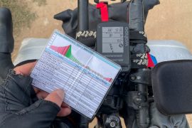
And not only that: it gives me a total of four possible routes. Once the original route, so to speak the first suggestion. In addition, I can ask the tool to show me three more alternatives. Of course, there is the corresponding elevation profile at the click of a button and a very comprehensive information about the trail conditions and surface.

The calculation takes a little time, but is completely ok, because you get just actually gravel-suitable tracks.
In addition to Gravel, the CXB Planner also offers Trekking-Gravel profiles. Here, trekking bike-friendly paths are combined with corresponding gravel routes. Good if you like to have a mix of fun and progress.

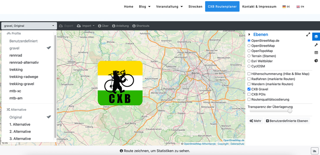
The map is set to Open Street Map by default, but can also be changed. In addition, altitude shading and bike paths can be displayed. This definitely helps in customizing the route.

The track is displayed by default as a pink-colored line. However, you can switch this and also have gradients displayed in color there.

Since a few days, the CXB Gravel route option also shows the gravel quality of the trails: depending on the type of red marked track, the quality is very good to good and single trails are also shown according to S-classification (S0 & S1).
I still find the radius meter interesting, although unfortunately this circle does not show me any distances. It is also labeled “No-Go Area”, marking an area that should not be included in the planning.

But CXB already has a solution for planning tours in the Corona-related 15km radius: For this, you have to create the corresponding radius at Canvayo and load the file generated there into the CXB route planner. Then the route planner shows this radius permanently and facilitates the planning of pandemic-compliant tours.

Summary
The CXBerlin route planner for gravel cyclists is very simple, understandable and intuitive to use. You can quickly click together a route and export it as a GPX.

I will use the tool to recalculate my local training route and also to finally make my longer training rides more gravelly. Try it out and give me feedback!
The best thing about all this: the planner is permanently free and you can start planning immediately without registration and download the routes in GPX format or share them with friends.